The Hemel Hempstead Map (above) has an interactive key which you can access by clicking the small arrow icon at the top left: ![]()
This identifies blocks of woodland that are publicly owned with public access, privately owned with public access, and all other woodland that is either private, inaccessible or unknown in status.
The map can be opened up to a full screen to allow a more detailed overview.
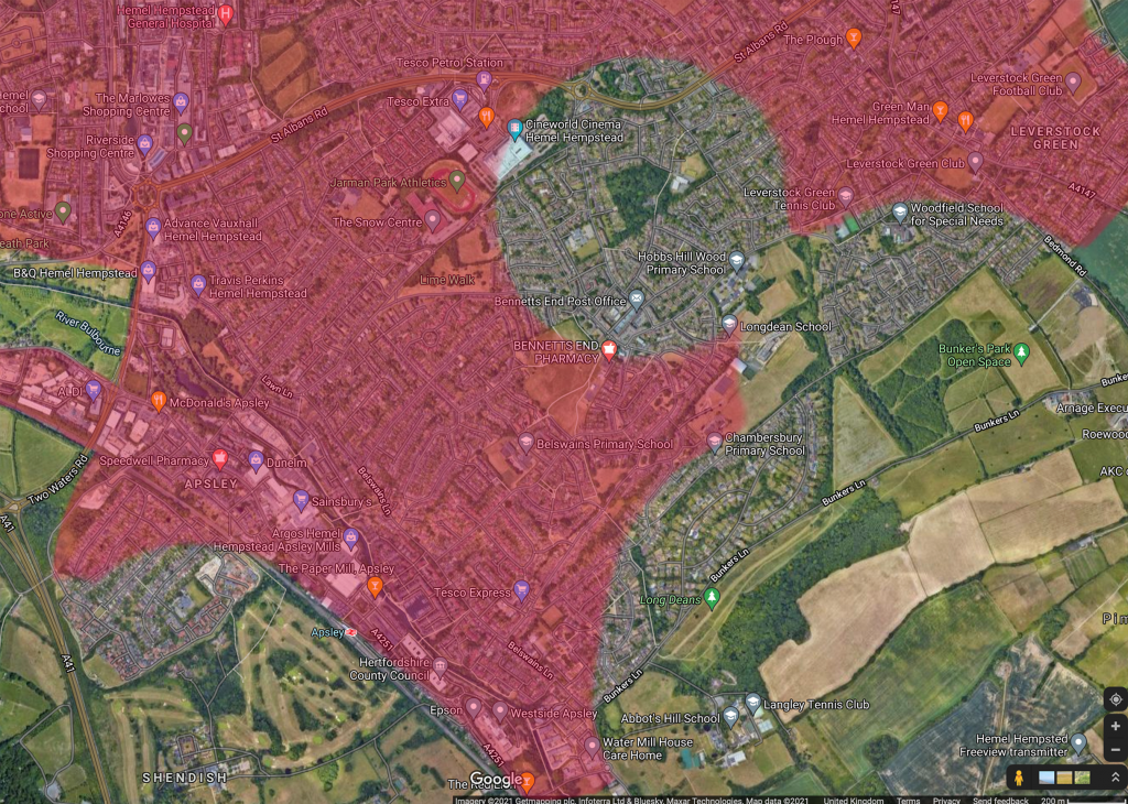
This map shows the south-east section of Hemel Hempstead illustrating the failure to follow the Woodland Trusts advice that everyone should have access to a woodland of at least 2 hectares within 500m of their home. The areas in red do not have this kind of access. More extensive development could reduce the areas of Hemel Hempstead that meet this recommendation.
This project is under constant development and we will try to include pictures and data about ancient or well established woodland with examples and sites of the oldest trees in the area. This data will give us a good estimation of how much woodland we have and whether we have enough for a healthy environment for everybody.